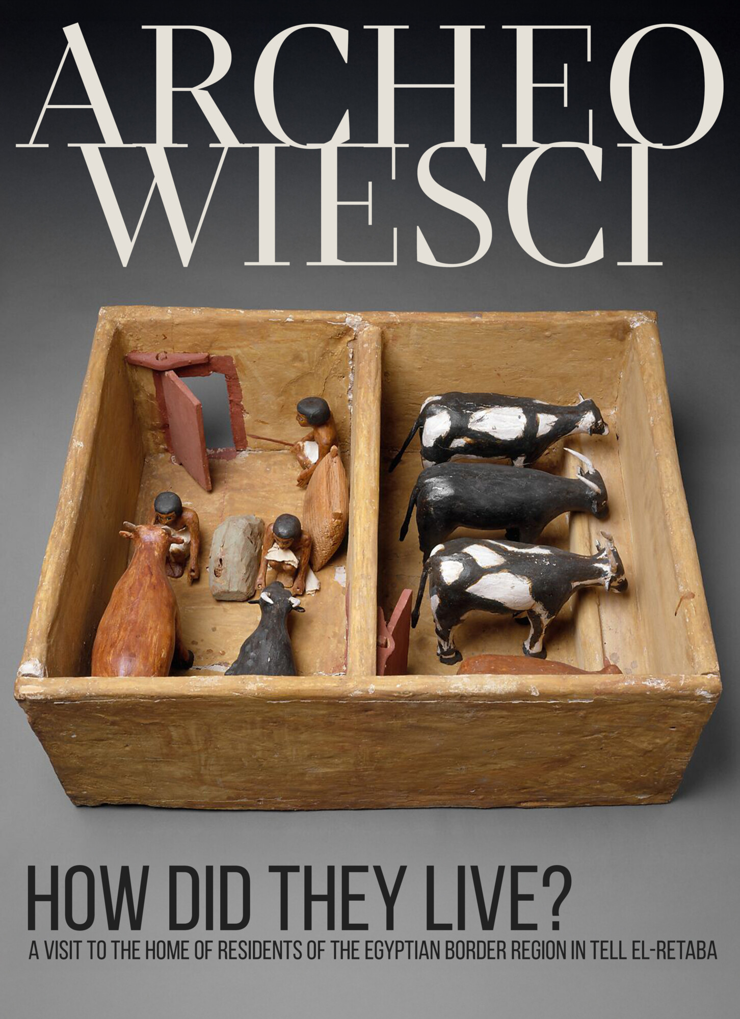
The first thing that comes to mind when we think of Ancient Egypt is monumental buildings – tombs and temples. Whether we like it or not, our image of antiquity in the time of the pharaohs is based on the perspective left behind by representatives of the elite. Meanwhile, settlement archaeology also gives us insight into the lives of other social classes, opening up opportunities for us to learn about the reality of ordinary people. In this article, we therefore travel to Tell el-Retaba in the first half of the 1st millennium BC – a settlement located on the Egyptian border – to see for ourselves how its inhabitants lived.
Public domain
Life in the wadi
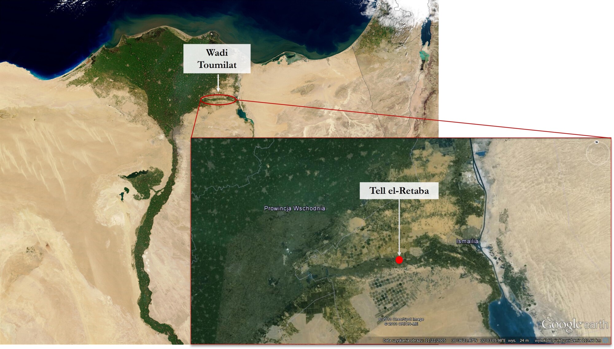
Tell el-Retaba is located in Wadi Tumillat, the ancient source of the Nile, which formed a green corridor between the Delta and the Sinai Peninsula. This made Wadi Tumillat a natural link for both trade and military purposes. Tell el-Retaba, located in the center of the wadi, dates back to the Second Intermediate Period, when a settlement inhabited by newcomers from the east – the Hyksos – developed here. Over time, Egyptians appeared here, coexisting with the existing inhabitants. During the reign of Ramses II and Ramses III, two fortresses were built here, one after the other, to defend the eastern border. On their ruins, in the first half of the 1st millennium BC, a settlement developed, whose inhabitants led a peaceful life, somewhat removed from the violent political changes of the Third Intermediate Period. And this was in a rather unusual setting, as it extended beyond the Nile itself.
“Wadi” is an Arabic term for a valley in desert areas that could fill with water during the rainy season. The landscape of Wadi Tumillat was therefore enriched by temporary lakes, often creating wetlands at the same time. Nevertheless, it was heavily dependent on the flooding of the Nile, which meant that dry periods alternated with wetter ones.
Public domain
Today, Wadi Tumillat is a heavily industrialized area densely covered with farmland. However, just over a century ago, the landscape looked completely different. At the beginning of the 20th century, research in Tell el-Retaba was conducted by Sir William Flinders Petrie (1853–1942), whose wife Hilda described Wadi Tumillat as a sparsely populated but green area with visible sand dunes.
Whether it looked similar in ancient times is currently difficult to say. However, modern geological studies indicate that the area around Tell el-Retaba was indeed periodically flooded, resulting in the formation of temporary lakes. The site itself was located on high ground, which meant that at that time it could even turn into an island. This landscape therefore seems to be completely different from that of the Nile Valley. What is more, everything indicates that the productivity of these areas was highly variable, depending on flooding, and only today’s agricultural capabilities are able to fully exploit the economic potential of Wadi Tumillat.
Simple houses, but a complex archaeological context
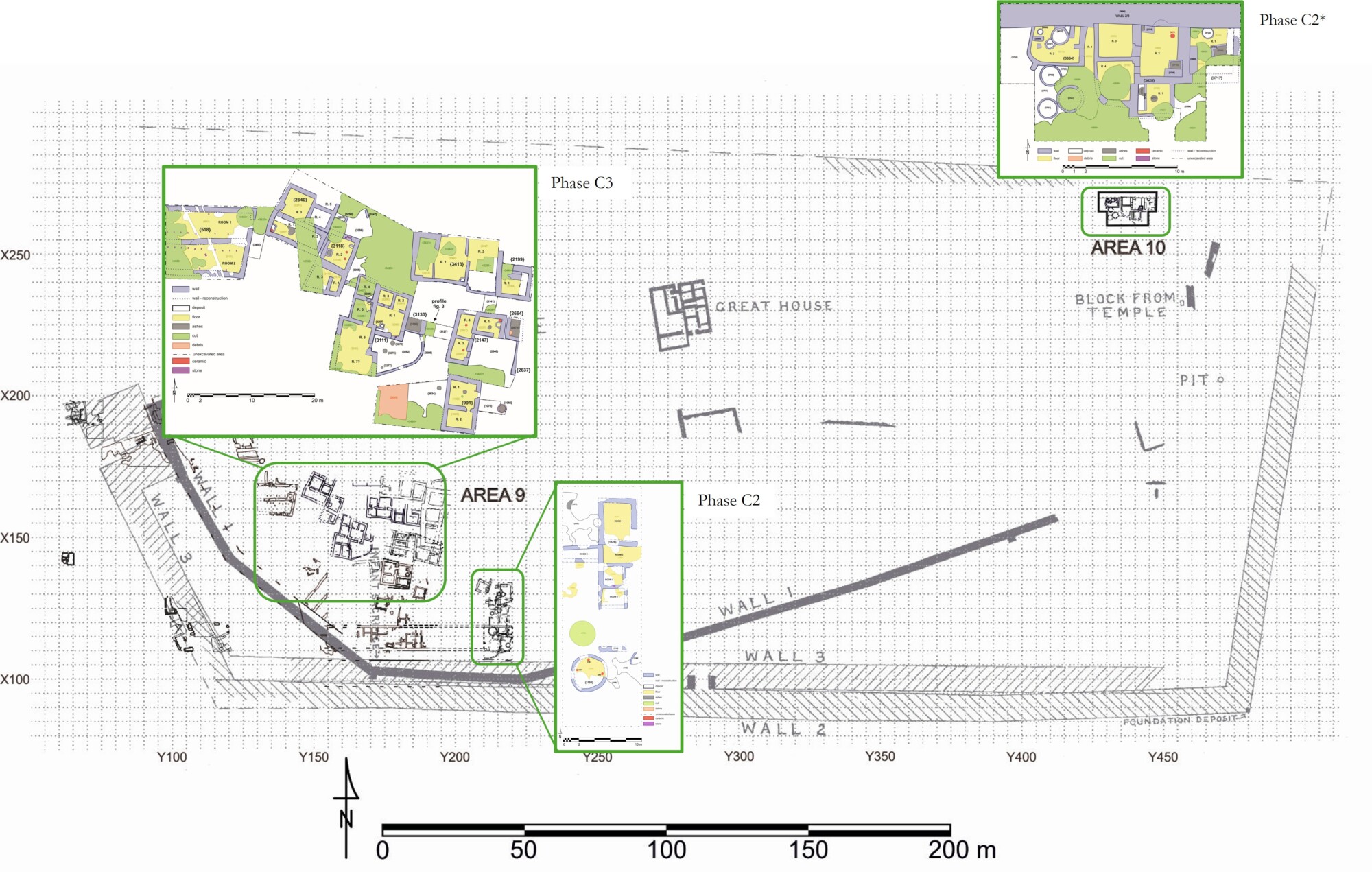
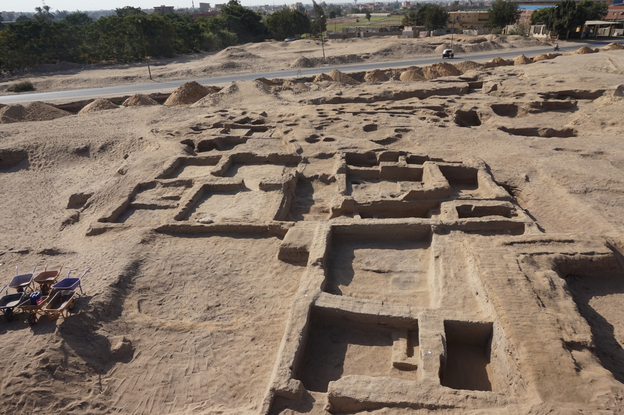
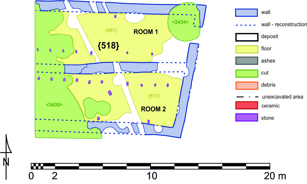
The settlement at Tell el-Retaba is the subject of research by the Polish-Slovak Archaeological Mission, led by PhD Sławomir Rzepka from the Faculty of Archaeology at the University of Warsaw. Over the years, a fairly large fragment of the site has been uncovered, but it is still only a fraction of the whole. The Polish mission is working in two areas, 9 and 10, where mainly residential and farm buildings have been uncovered so far. Built of sun-dried mud bricks, they are fairly simple, mostly single-story structures. However, as a complete archaeological context, they pose a real interpretative challenge.
© S.Rzepka, licensed under CC BY-NC 4.0
A characteristic feature of mudbrick architecture is its variability, resulting from the adaptation of living space to the current needs of residents. It is therefore not surprising that numerous reconstructions and changes occur during the use of buildings. However, these changes significantly affect the interpretation of movable monuments found inside them. How can we tell whether a given object was used, stored, or abandoned in a given place? It turns out that correctly identifying the function of a tool is only half the battle. In order to link this role to the function of the room itself, one must first understand the processes that led to the object being found in a specific archaeological context – e.g., in a floor layer, a collapse, or a rubbish heap. This makes the interpretation process more complex than simply stating that the place of discovery equals the place of use.
A characteristic feature of mudbrick architecture is its variability, resulting from the adaptation of living space to the current needs of residents. It is therefore not surprising that numerous reconstructions and changes occur during the use of buildings. However, these changes significantly affect the interpretation of movable monuments found inside them. How can we tell whether a given object was used, stored, or abandoned in a given place? It turns out that correctly identifying the function of a tool is only half the battle. In order to link this role to the function of the room itself, one must first understand the processes that led to the object being found in a specific archaeological context – e.g., in a floor layer, a collapse, or a rubbish heap. This makes the interpretation process more complex than simply stating that the place of discovery equals the place of use.
© Ł. Jarmużek, licensed under CC BY-NC 4.0
© S.Rzepka, licensed under CC BY-NC 4.0
In summary, interpreting and identifying activities that took place in houses is a complex task. It requires a functional analysis of both the objects themselves and the context in which they were found. This poses many problems, primarily related to the assessment of the processes that led to the placement of a given object in a specific location.
Working at home
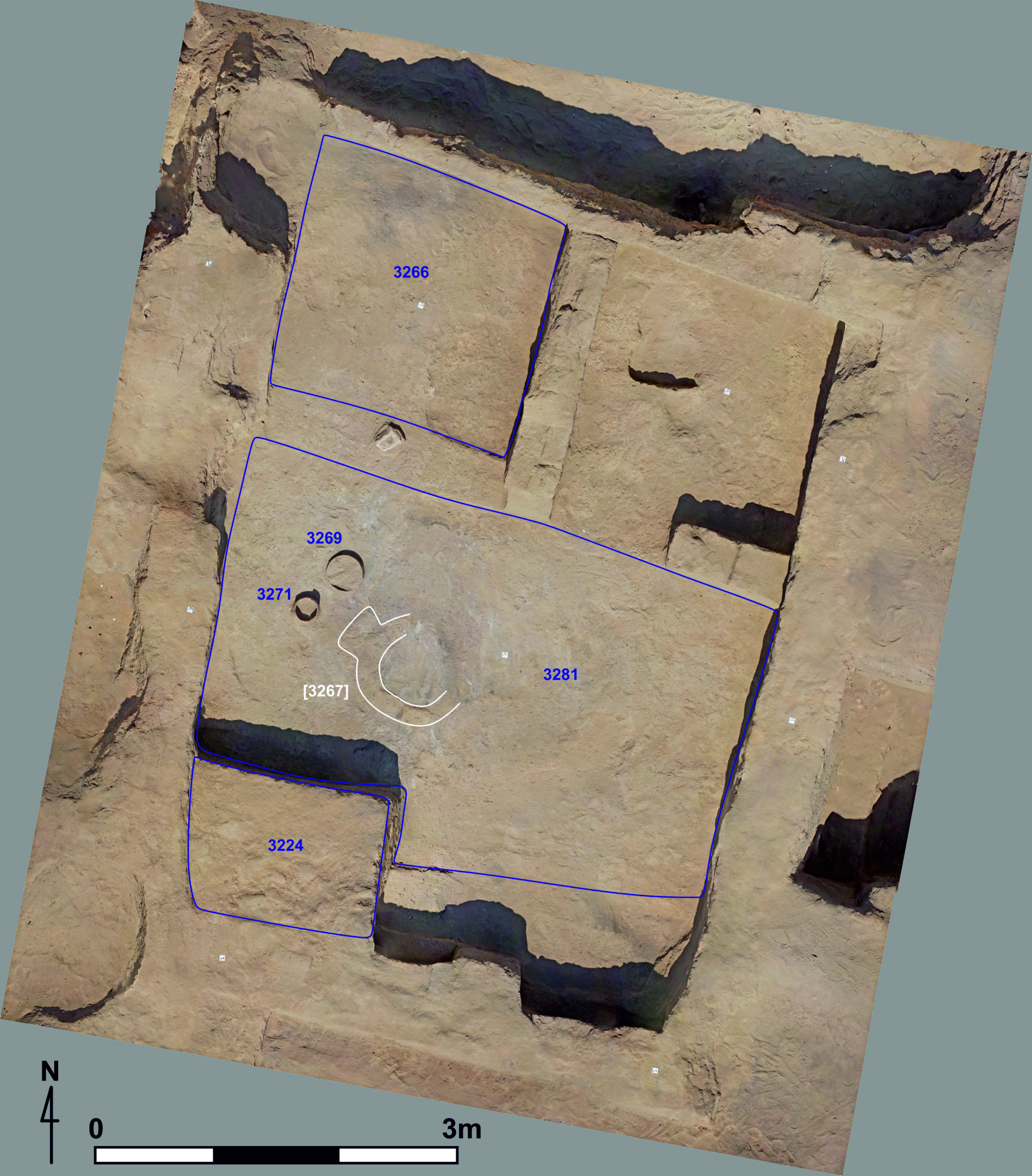
The houses in the settlement from the Third Transitional Period consisted of 3 to 5 rooms and, as already mentioned, were probably single-story structures, although it cannot be ruled out that they had functional roofs. The identification of storage spaces is an interesting issue. In one of the parts of the site under investigation, known as Area 9, the houses discovered were rarely equipped with larger storage structures such as silos. It seems that grain was stored there only in small quantities, intended for quick consumption. The situation is different in the so-called Area 10, where numerous remains of such silos have been identified, the presence of which may suggest that this part was part of a larger estate belonging, for example, to a representative of the upper social classes. Moreover, the considerable size of these storage spaces indicates that the grain stored there may have been intended for redistribution among the inhabitants who were economically dependent on the owner of these rooms, whom we call the patron.
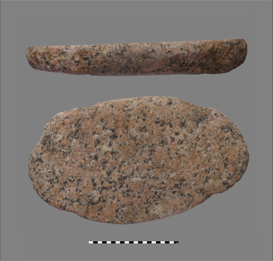
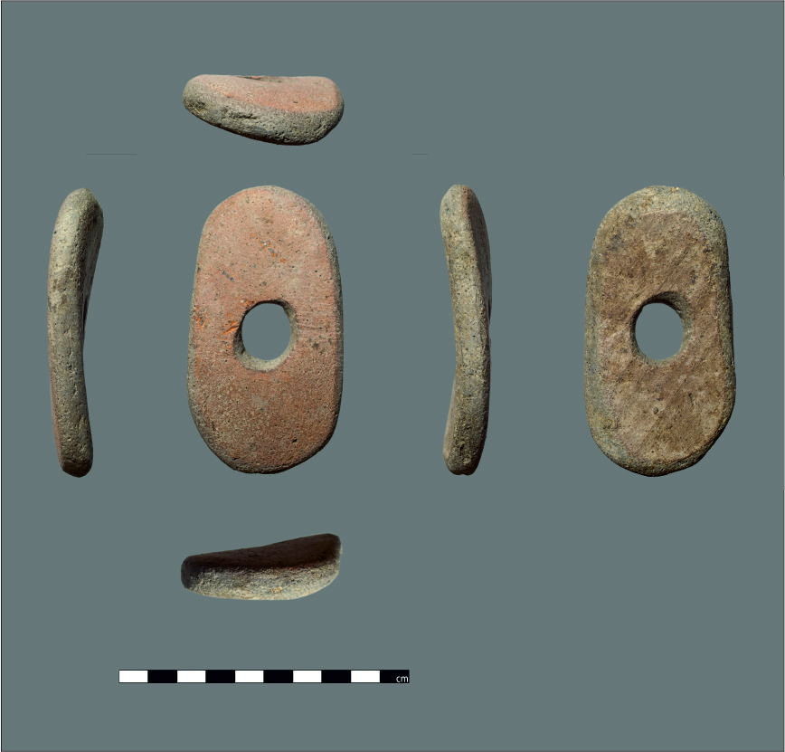
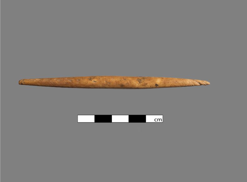
Further interesting information about what the households in Tell el-Retaba looked like and how they were used is provided by analyses of the equipment discovered there. This indicates that the spaces were clearly multifunctional and were used both for everyday activities – such as grinding grain for bread, cooking, and sleeping – and for craft activities. The lack of separate workshop areas may indicate that craftsmanship was carried out on a small scale and was limited to meeting the needs of the household or the local community.
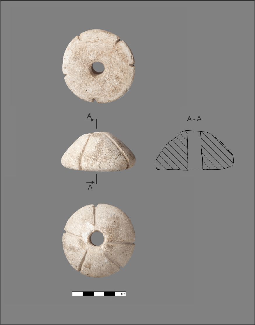
Photo by M. Rekłajtis, drawing by J. Świsłocki, licensed under CC BY-NC 4.0
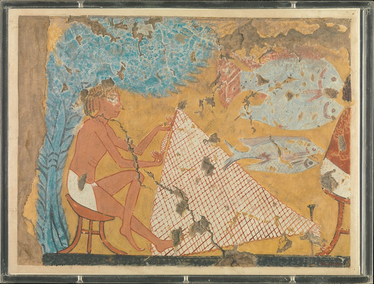
What exactly was produced in these houses? Archaeological evidence points to weaving, basketry, and fishing net production. It seems that small metal, stone, bone, and wooden objects were also made. However, the lack of installations related to these activities makes it difficult to clearly identify where in the house they were carried out. It is only possible to make a general statement that a given activity took place in a given area and at a given stage, without the possibility of conducting a more detailed spatial analysis.
© M.Rekłajtis, licensed under CC BY-NC 4.0
It is impossible to distinguish any characteristic features of the spatial layout of the houses. It seems that the elements that distinguish residential buildings from others are the presence of benches (from the Arabic mastaba), mud containers (biny), and small hearths.
© M.Rekłajtis, licensed under CC BY-NC 4.0
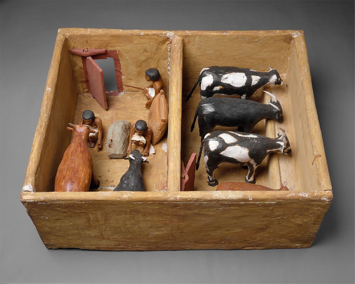
Outside the home
The lives of the inhabitants of Tell el-Retaba were not focused solely on work at home. Numerous items related to fishing found in homes clearly indicate how important this element of daily activity was. Geological studies have also shown that lakes temporarily formed around the site, which were probably the main source of fish. We also know that the inhabitants hunted to some extent, as evidenced by the gazelle bones found at the site.
Public domain
The remains of two buildings, interpreted as farm buildings, were also found near the houses. They were used to keeping animals, but unfortunately it is not possible to identify unequivocally what animals were kept there. Judging by their size and analogies with other sites, it is assumed that the larger one was used to keep cows, while the smaller one could have been used to keep goats or sheep. It is difficult to link these buildings to specific residential houses, which may mean that caring for animals was a shared responsibility of the inhabitants.
© Ł. Jarmużek, licensed under CC BY-NC 4.0
However, can we conclude that the main occupation of the inhabitants of Tell el-Retaba was animal husbandry? This is entirely possible, especially since agriculture does not seem to have been the dominant form of activity in this community. There are two reasons for this conclusion: 1) the relatively small number of artifacts related to farming, and 2) the environmental conditions of the Wadi.
Public domain
Summary
The inhabitants of Tell el-Retaba in the Third Intermediate Period led a simple life, far from the political turmoil of their era. They probably focused on animal husbandry and daily chores carried out in the comfort of their own homes. It can be assumed that they were economically dependent on a patron, who may also have been responsible for distributing grain among the inhabitants.
Thanks to research at Tell el-Retaba, we can take a look at the daily life of the people living in a small settlement on the outskirts of ancient Egypt – far from palaces, temples, and political turmoil. This is a rare opportunity to see how an ordinary community in the Egyptian province functioned.
Bibliography
Jarmużek, Łukasz. 2013. ‘A stable of the Third Intermediate Period at Tell el-Retaba’. The Journal of Egyptian Archaeology 99(1): 281–89. https://doi.org/10.1177/030751331309900117.
Jarmużek, Łukasz, Agnieszka Ryś, Anna Wodzińska, Piotr Sójka, and Sławomir Rzepka. 2023. ‘Living on the ruins of a New Kingdom fortress. Results of the Polish-Slovak Archaeological Mission at Tell el-Retaba, Season 2021’. Ägypten und Levante 32:95–125. https://doi.org/10.1553/AEundL32s95.
Jarmużek, Łukasz, Agnieszka Ryś-Jarmużek, Anna Wodzińska, Anna Gręzak, Claire Malleson, and Sławomir Rzepka. 2024. ‘After the fall of the Egyptian Empire: Review of the Third Intermediate Period settlement at Tell el-Retaba’. Antiquity 98 (398): e11. https://doi.org/10.15184/aqy.2024.22.
Jarmużek, Łukasz, Sławomir Rzepka, and Agnieszka Ryś. 2019. ‘Tell el-Retaba 2017. Third Intermediate Period settlement’. Ägypten und Levante 29:53–78. https://doi.org/10.1553/AEundL29s53.
———. 2020. ‘Tell el-Retaba in the 1st Millennium BC. Results of the Polish-Slovak Archaeological Mission, season
Author: Agnieszka Ryś-Jarmużek is an archaeologist specializing in settlement archaeology in the Nile Valley, working at the Faculty of Archaeology at the University of Warsaw. Since 2012, she has been a member of the Polish-Slovak Archaeological Mission in Tell el-Retaba.
ORCID: https://orcid.org/0000-0001-8923-8856
Academia: https://uw.academia.edu/AgnieszkaRy%C5%9B
ReaserchGate: https://www.researchgate.net/profile/Agnieszka-Rys-Jarmuzek?ev=hdr_xprf
Editing : A.C
Transaltion: A.B.
The text was written as part of the funding for the project “Campaign promoting research by the Faculty of Archaeology of the University of Warsaw in the Nile Valley” from the Initiative of Excellence – Research University program (IDUB)